world tile
This block is part of the openstreetmap group and was last modified in core v15.0.0.
world tile v15.0.0 Fetch OSM world geometry for a slippy-map tile (z/x/y) as GeoJSON (roads, buildings, water, greenery). Recommended zoom: 15. Geometry is simplified per zoom (buildings stay crisp at z≥15).
- flow
flow - z (zoom) required
v15.0.0numberSlippy-map zoom level (1–22). Recommended: 15.
- x required
v15.0.0numberSlippy-map tile column.
- y required
v15.0.0numberSlippy-map tile row.
- kinds
v15.0.0objectOptional array (or comma-separated value) limiting which feature kinds are returned:
road,building,water,green. Empty returns all four. - overpass url
v15.0.0valueOptional Overpass interpreter URL. Empty uses the public instance : set a self-hosted instance in production.
- cache ttl (s)
v15.0.0numberDisk-cache freshness in seconds. Empty/0 uses the default (7 days); negative disables caching. Tiles are cached per z/x/y under the configured osmworld cache path.
- flow
flow - geojson
v15.0.0objectGeoJSON FeatureCollection (WGS84, lon/lat). Feed into httpconnection_set_json.
- count
v15.0.0numberNumber of features returned.
- success
v15.0.0conditionTrue when the tile was fetched successfully.
- error
v15.0.0valueError message when success is
false.
osm |
openstreetmap |
geojson |
world |
tile |
overpass |
map |
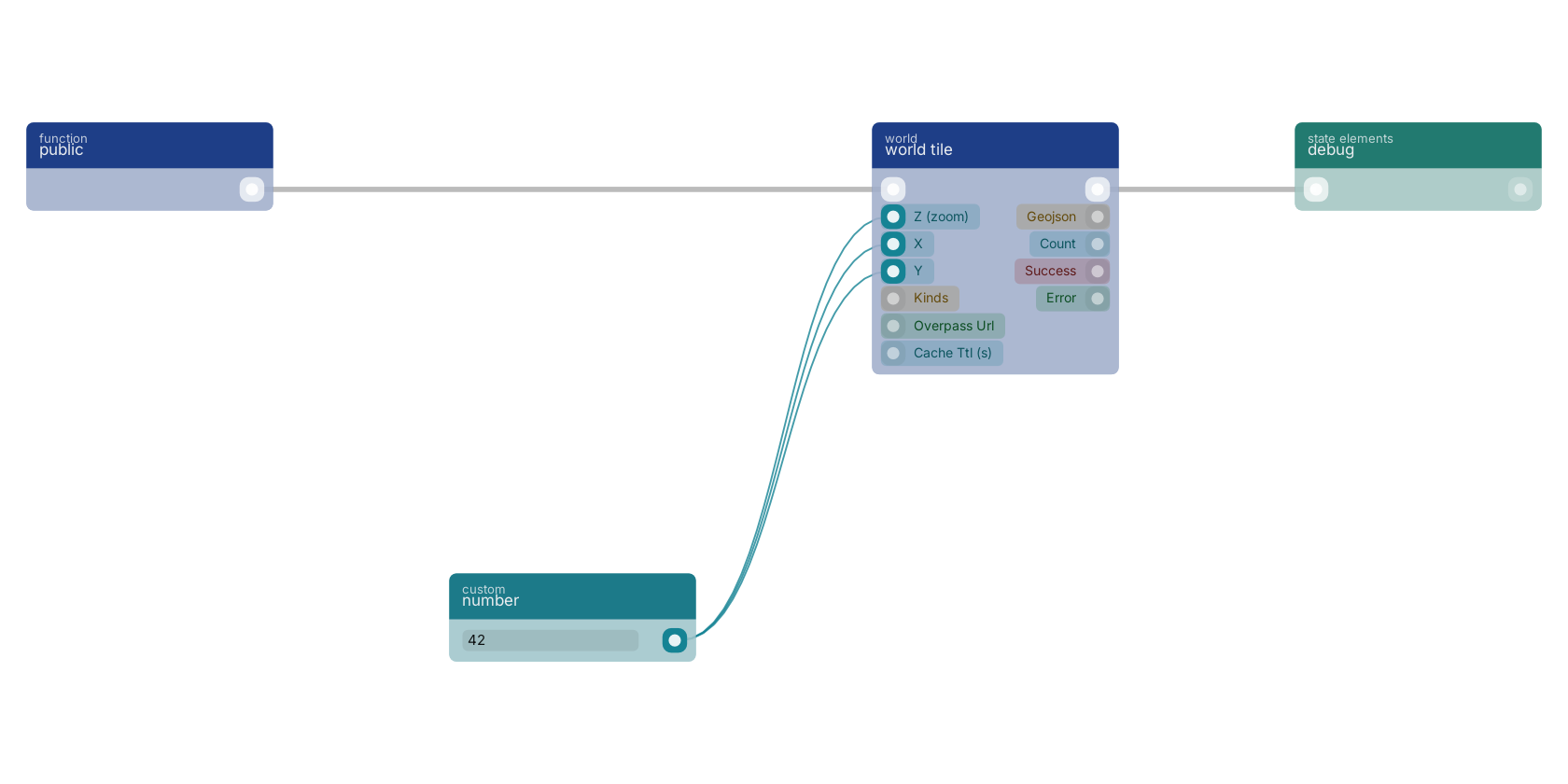
A typical wiring for world tile: a function trigger starts the flow; number feeds the z pin; number feeds the x pin; number feeds the y pin; the flow out pin feeds debug.
Used in these guides
These documentation pages use or explain this block:
Version history
Introduced in v15.0.0.
Back to
openstreetmap Return to the main group to view all sub-groups Back to world Return to the group to view all blocks within this group