get lat / lon
This block is part of the geopoint group and was last modified in core v12.0.0.
get lat / lon v12.0.0 Returns the latitude and longitude of a given geo point
In pins 1
- geo point required
geo_point
Out pins 2
- latitude
number - longitude
number
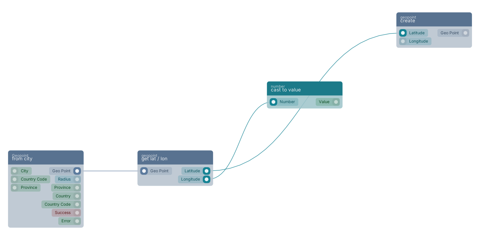
A typical wiring for get lat / lon: from city feeds the geo_point pin; the latitude out pin feeds create; the longitude out pin feeds cast to value.
Commonly used with
In production blueprints, this block is most often wired together with:
- create: this block feeds into it. Generates a geo point based on the given latitude and longitude.
- cast to value: this block feeds into it. Converts the given number into a value.
- create: feeds into this block. Creates a new function that can be executed using the given name.
- get fields: feeds into this block. Gets the selected fields from the given object.
- nearest places: feeds into this block. Finds the nearest points of interest to a geo point, ordered by distance, with the distance to each in metres. Leave max distance empty for an unbounded search — because you get distances back rather than a yes/no, you can apply any radius afterwards without querying again, which is what makes a free-choice radius slider possible. Data is Overture Maps Places; see places_dataset_info for the release, and note that counts are indicative rather than a register.
Used in these guides
These documentation pages use or explain this block:
Version history
Introduced in v12.0.0.
Back to
geopoint Return to the main group to view all sub-groups Back to geopoint Return to the group to view all blocks within this group