place density
This block is part of the places group and was last modified in core v15.0.0.
place density v15.0.0 Measures how built-up the area around a point is: how many places sit within the radius, the rate per km², a breakdown per category, and a classification (dense_urban, urban, suburban, rural). The classification is driven by the per-km² rate rather than the raw count, so it does not change when you change the radius. Data is Overture Maps Places.
- geo point required
v15.0.0geo_pointCentre of the measurement.
- radius (m)
v15.0.0numberMeasurement radius in metres. Empty uses 500.
- categories
v15.0.0arrayArray or comma-separated list of category groups. Accepts group ids (
primary_education) or Dutch synonyms (basisschool,kroegen). Empty searches every category. Useplaces_categoriesto list them.
- total
v15.0.0numberPlaces within the radius, after deduplication.
- raw total
v15.0.0numberUnderlying records before deduplication.
- per km²
v15.0.0numberPlaces per square kilometre : the figure the classification is based on.
- by group
v15.0.0objectCount per category group.
- top groups
v15.0.0arrayCategory groups ordered by count, most common first.
- classification
v15.0.0valuedense_urban,urban,suburbanorrural. - success
v15.0.0conditionTrue when the query ran. An empty result is still a success.
- error
v15.0.0valueError code when the query could not run:
PLACES_NOT_AVAILABLE,GEO_POINT_MISSING_LAT_OR_LON.
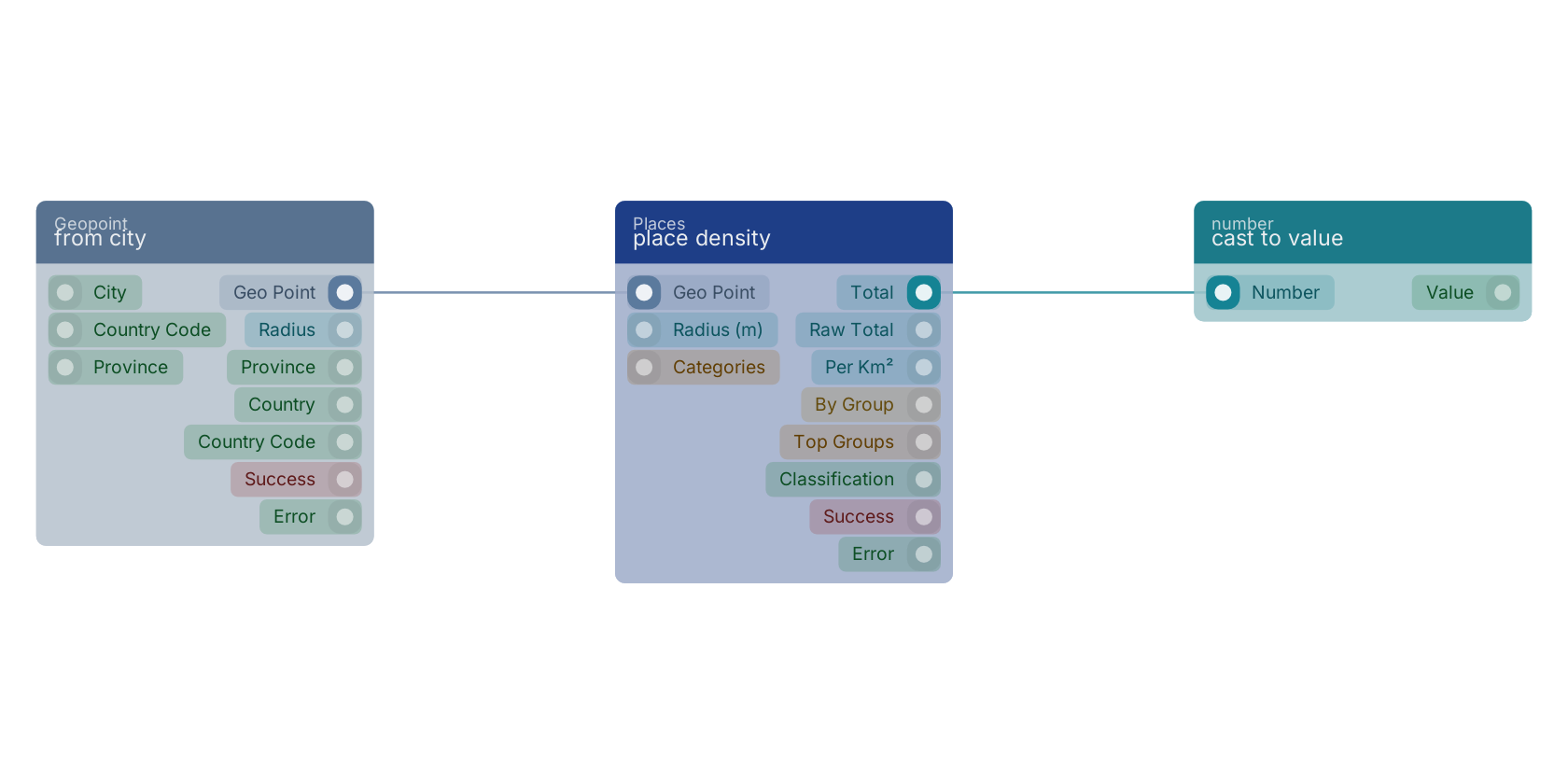
A typical wiring for place density: from city feeds the geo_point pin; the total out pin feeds cast to value.
Used in these guides
These documentation pages use or explain this block:
Version history
Introduced in v15.0.0.
Back to
places Return to the main group to view all sub-groups Back to Places Return to the group to view all blocks within this group